The RPC uses GIS (Geographic Information Systems) for many different types of applications and is responsible for maintaining various datasets related to land use such as zoning, overlay districts, and growth plan areas.
The Planning Commission offers services regarding GIS and its applications to various city and county offices, as well as the public. The RPC has created a series of interactive web maps as well as PDF maps for printing. Maps are updated on a regular basis with new maps and tools being added. More mapping and GIS information can be found at the websites listed on the right under Additional Information.
For mapping information please contact Daniel Morris. Fees for information will be based on the size of map requested, number of files needed, and amount of time needed to complete the request.
Fee Schedule
Interactive Maps
(Click on title to expand/collapse content)
Downloadable PDF Maps
(Click on title to expand/collapse content)
| Downloadable PDF Maps | |
|---|---|
 |
Zoning Map Poster 36×36 street map; 1 MB file size; Updated February 8, 2019 |
 |
Zoning Map Book Indexed individual 8.5×11 maps; 23 MB file size; Updated February 8, 2019 |
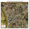 |
Downtown Urban Design and Historic District Overlay Map 8.5×11 aerial Image (2022); <1 MB file size; Updated July , 2023 |
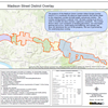 |
Madison District Overlay Map 11×17 street map; <1 MB file size; created July 1, 2018 |
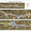 |
Madison District Overlay Map Poster 36×36 aerial image (2016); 6 MB file size; created July 1, 2018 |
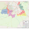 |
Clarksville-Montgomery County Growth Plan Map 11×17 street map; 1 MB file size; Updated February 1, 2020 |
 |
Montgomery County Poster 36×36 aerial image (2016); 21 MB file size; Updated February 8, 2019 |
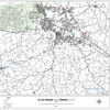 |
Montgomery County Road Map 36×36 street map; 4 MB file size; Updated February 8, 2019 |
 |
City Street Map 36×36 street map; 4 MB file size; Updated February 8, 2019 |
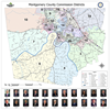 |
Montgomery County Commission District Poster 36×36 Poster; 3.8 MB file size, Updated January 2, 2022 |
 |
Montgomery County Commission District Mapbook Indexed individual 8.5×11 maps; 3 MB file size; Updated January 2, 2022 |
 |
Clarksville City Wards Poster 36×36 Poster; 5 MB file size; Updated June 2, 2023 |
 |
Clarksville City Wards Mapbook Indexed individual 8.5×11 maps; 3 MB file size; Updated June 2, 2023 |
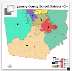 |
CMCSS School Districts Poster 24×24 Poster; 1 MB file size; Updated January 27, 2022 |
| Sabre Overlay District | |


